




NOAA says El Niño is strengthening and has a 97 percent chance of lasting into early spring 2027, focusing attention on Los Angeles before winter. The outlook does not guarantee extreme weather, but it highlights flood, debris-flow and coastal risks that communities and emergency agencies will need to track.
Key Takeaways
- NOAA expects El Niño to strengthen through 2026 and gives it a 97 percent chance of continuing into early spring 2027.
- Forecasters place the chance of a very strong event during October through December at 81 percent.
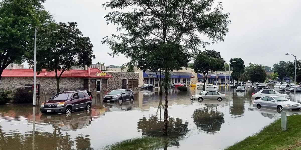
- Intense rain could create urban flooding, debris flows near burn areas and coastal erosion when combined with high surf and elevated tides.
- Local effects will depend on individual storms, rainfall intensity, soil conditions, tides and wave direction.
El Niño has returned to the tropical Pacific, and NOAA’s July 9 update places the climate pattern on course to intensify through the end of the year. Forecasters said the event could rank among the largest recorded since 1950 if it reaches the projected very strong category during October through December.
That probability is the clearest new development in the winter outlook. It also comes with an important limit.
NOAA states that El Niño strength does not automatically determine local effects. Even a very strong event cannot guarantee above-normal rain in a particular city or watershed.
El Niño forms when unusually warm water across the central and eastern equatorial Pacific interacts with the atmosphere. The shift can alter the Pacific jet stream and the preferred route of winter storms across North America.
For Los Angeles, the connection is meaningful but uneven. Research using precipitation records from 1901 through 2010 found that El Niño’s influence on California precipitation becomes stronger later in winter and is more pronounced in Southern California.
Eight of 10 moderate-to-strong events placed the region in the wettest third during late winter. The relationship does not establish what will happen in 2026-27, but it explains why agencies are watching conditions before the rainy season.
Flood and Debris-Flow Risks Could Converge
Los Angeles does not need a record-wet season to experience disruption. A few intense storms can overwhelm streets, underpasses and drainage channels when rainfall arrives faster than water can move through the urban system.
The sharper risk may develop near recently burned hillsides. Wildfires remove vegetation and can leave soil less able to absorb rainfall. Water may then move rapidly downhill while carrying mud, rocks and branches.
The National Weather Service identifies burn scars as areas where flooding can produce mud and debris flows. Even a short burst of heavy rain may create dangerous conditions where slopes were recently damaged by fire.
That concern extends across Los Angeles County. The recent Santa Clarita brush fire burned 52 acres in July after spreading across steep terrain near homes and transportation infrastructure. The fire illustrates how new burn areas become part of winter storm planning.
Recently burned areas may remain vulnerable to flash flooding and debris flows during rainstorms. Repeated rainfall can also saturate slopes and increase landslide or rockfall risks after the initial downpour.
Officials will need to evaluate each storm based on rainfall rates, soil conditions and the location of affected slopes. Seasonal forecasts alone cannot identify which neighborhoods will face the greatest danger.
Coastal Los Angeles Faces Separate Winter Hazards
Along the coast, El Niño introduces a different set of concerns. Storm-driven waves, elevated water levels and high tides can combine to push flooding farther inland and accelerate beach or bluff erosion.
Timing matters more than the seasonal label alone. Two storms with similar rainfall totals may produce different coastal impacts depending on wave direction, tide levels and wind.
Past king tides and high surf have already drawn attention to flooding exposure along Southern California beaches. During winter, overlapping wave and tide events could affect beach access, parking areas, coastal roads and properties near vulnerable bluffs.
Repeated wave action may also remove sand and place more pressure on shoreline infrastructure. Saturated coastal slopes can become unstable after consecutive storms, especially where erosion has already weakened bluffs.
These hazards may occur even if inland rainfall falls below early expectations. A winter does not need to produce exceptional regional rainfall to cause significant damage in exposed coastal areas.
Los Angeles Readiness Depends on Individual Storms
Seasonal forecasts provide probabilities, not street-level predictions. The practical risk will depend on rainfall rate, storm duration, soil saturation, wind, tides, wave direction and the location of recent burn scars.
Residents in hillside, canyon, coastal and flood-prone areas should follow National Weather Service alerts and local evacuation guidance. Clearing drains, checking roofs and gutters, reviewing evacuation routes and identifying nearby flood zones can address known risks before rain begins.
Businesses may face short-notice disruptions from road closures, transit delays, power outages and restricted access. Outdoor events, delivery operations and coastal sites may need flexible plans when watches or warnings are issued.
Emergency agencies will also monitor whether storms arrive close together. A series of systems can leave soil saturated, reduce drainage capacity and create hazards that persist after rainfall ends.
The El Niño outlook supports preparation rather than certainty. NOAA is expected to continue updating its forecast as new ocean and atmospheric data become available.
Individual storm forecasts will provide the clearest measure of immediate Los Angeles risk. Until then, El Niño remains an important seasonal signal for residents, businesses and local agencies preparing for the 2026-27 winter.
Frequently Asked Questions
Is El Niño Certain to Make Los Angeles Wetter?
No. El Niño can shift the odds toward familiar seasonal patterns, but its strength does not guarantee a specific result in every location. Los Angeles rainfall will depend on the number, route and intensity of individual storms.
How Strong Could This El Niño Become?
Forecasters place the chance of a very strong El Niño during October through December 2026 at 81 percent. An event of that strength could rank among the largest in records dating to 1950.
Why Are Burn Areas at Greater Risk?
Fire can remove vegetation and change how soil absorbs water. During heavy rain, rapid runoff may carry mud, rocks and debris into roads, channels and communities below burned slopes.
Which Los Angeles Areas Face Coastal Risk?
Beaches, low-lying shoreline areas, coastal roads and properties near unstable bluffs may face higher exposure when large waves, high tides and storm-driven water occur together. The exact impact will depend on local conditions during each storm.